Lessons from the Nyiragongo Eruption
Context:
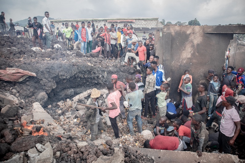
In May 2021, the Mount Nyiragongo volcano erupted near Goma, the capital of North Kivu Province in the Democratic Republic of Congo (DRC). The eruption was a devastating blow for a region that has faced a continuous humanitarian emergency since 1996 due to civil conflict. In just a few hours, the lava destroyed over 3,500 homes, schools, and health centers. By the end of the day, more than 400,000 people had fled their homes, many seeking refuge in overcrowded shelters in schools, churches, and other public spaces. This was not, unfortunately, the first eruption of the volcano in modern times. I witnessed firsthand the destruction of the 2002 eruption and the efforts of Goma’s citizens to adapt to the unending cycle of violence and displacement during my work with Doctors Without Borders
The Congolese authorities and international humanitarian organizations led the emergency response. The local administration coordinated the evacuation of the population whle UNICEF, UNHCR, the Red Cross, and other humanitarian actors mobilized and provided the population with shelter, food, water, sanitation, and essential items. Despite these efforts, overcrowded shelters increased the risk of cholera and other diseases, and the rapid displacement complicated the coordination of aid.
As is common in emergencies of this scale, the lack of reliable information on the number and location of affected people hindered a swift and effective response. The traditional method for gathering information in disaster contexts is conducting on-the-ground population assessments. While these surveys can provide accurate data, they require meticulous design and implementation, making the process both time-consuming and costly.
Leveraging mobile phone operator data to estimate population displacement
Several methods have been used to complement or replace traditional population assessments in the last few years, including community feedback, mobile phone-based surveys, and satellite data. In the case of the Goma crisis, another innovative approach was implemented.
Flowminder is a Swedish non-profit foundation that analyzes anonymized mobile operator data, satellite imagery, and household surveys to map population distributions and movements. During the Nyiragongo eruption, Flowminder offered a pioneering solution by partnering with Vodacom RDC to analyze anonymized Call Detail Records (CDRs) from mobile phones. This collaboration provided precise insights into displacement patterns, becoming an essential tool for targeted aid delivery and long-term recovery planning.
Flowminder’s analysis provided insights into where displaced populations had relocated, such as Bukavu, Rutshuru, and Sake-Masisi. This allowed aid organizations to better target their efforts, ensuring resources reached those in need.
Flowminder’s analysis also had significant public health implications. By pinpointing areas of high population density, the data enabled targeted health interventions and the distribution of hygiene supplies. This strategy helped reduce the risk of disease outbreaks and played a key role in containing the transmission of several isolated cases of cholera.
The data also played a crucial role in the recovery phase by offering detailed insights into population movements over time. By tracking displaced populations and monitoring their gradual return to Goma, it enabled stakeholders to allocate resources for rebuilding efforts, including housing, infrastructure, and essential services, ensuring that recovery initiatives aligned with actual needs.
Despite its benefits, the Flowminder data only became publicly available nearly two months after the eruption, on July 20, 2021. While this delay limited its impact on the immediate emergency response, the technology demonstrated enormous potential for real-time application in future crises. Strict privacy protocols ensured that subscriber data remained anonymized and secure, a crucial factor in maintaining public trust and ethical standards.
Key Takeaways
This approach has implications far beyond this disaster. Mobility data analysis offers a scalable solution for any region with a functioning mobile network. It is also valuable in war zones or areas where security concerns hinder on-the-ground assessments. Combined with other remote data sources, such as satellite imagery or drones, it enables a comprehensive understanding of displacement patterns and valuable information on humanitarian needs.
However, remote methods alone cannot fully capture the humanitarian needs of affected populations. Social media analysis could add valuable context, and analyzing keywords from phone calls could provide insights into urgent needs. However, ethical constraints currently limit such approaches until privacy can be reliably guaranteed. As of today, combining remote data with community-based assessments offers the best of both worlds, balancing real-time information with an in-depth understanding of the population’s needs at a later stage.